Introduction
An unmanned aerial vehicle (UAV) commonly called as drone in modern technical terms is an aerial vehicle or aircraft without onboard human pilot and is controlled by the means of communications based on electronic radars with the help of controllers. The UAV is capable of autonomous waypoint navigation using onboard GPS processing and is under controlled by the human operator, autonomously by onboard computers or by artificial intelligence. In this article, we will see the classification and applications of UAVs.
The Unmanned aerial vehicles (UAVs) have been used for centuries. The earliest record use was by Austrians back on 1849. When we traced back the history on the invention of UAVs, we find that it was first used for loaded explosives. Although balloons wouldn’t be consider a UAV today, this was the technology that led to the invention of modern UAV.
With new development the invention of drone, miniature and micro UAVs were introduced. In the early 2000s, Dragonfly Inc. made available a multi-rotor system called Dragonfly. This made the beginning of modern quad copters after which they started becoming widely available to people. The current phase UAV development now includes the vast defense research program held by The Defense Advanced Research Projects Agency (DARPA) in United States is currently developing autonomous UAV which is powered by a brain like neuromorphic chip.
Coming to the search and rescue activities, the applications of UAVs can be divided into four stages: mitigation, preparedness, response and recovery. Search and Rescue (SAR) operations are those conducted in the response phase, aiming to find and provide itself to the greatest number of people in the last hours of disaster trying to minimize their chances of survival.
Aerial vehicles are obviously well suited to give a bird’s eye view over an incident, surveillance, or reconnaissance site. They offer hence interesting options as robotics tools for assisting in safety, security, and rescue missions. The potential advantages of an unmanned platform, however, depend on many factors, such as aircraft, sensor types, mission objectives, and the current UAV regulatory requirements for operations of the particular platform.
UAV Classification, Characteristics and Discussion
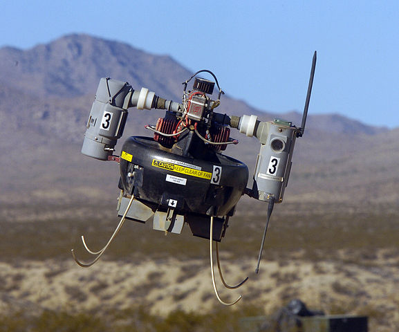
Unmanned aircraft systems consist of the aircraft component, sensor payloads, and a ground control station. The latter, operated by one or more people in addition to a dedicated human “pilot”, varies widely in its configuration depending on the platform and mission. Classification of UAVs for civil scientific uses largely based upon the characterization such as size, flight endurance and capabilities based on the lift of the loads and masses it rely upon. The fellow class unmanned aerial vehicles are mainly used in the field of tracking, rescuing and surveillance with the help of GPS tracking, thermal sensing with the viewpoint before its deployment on basis of rule and regulations imposed by a particular government.
1. MAV (Micro (or Miniature) or NAV (Nano) Air Vehicles)
They are so called because of their size, which typically enables military versions of these aircraft to be transported within individual soldiers’ backpacks.
These aircraft tend to operate at very low altitudes (<330 m), with size limitations on battery capacity leading to short flight times.
2. VTOL (Vertical Take-Off & Landing)
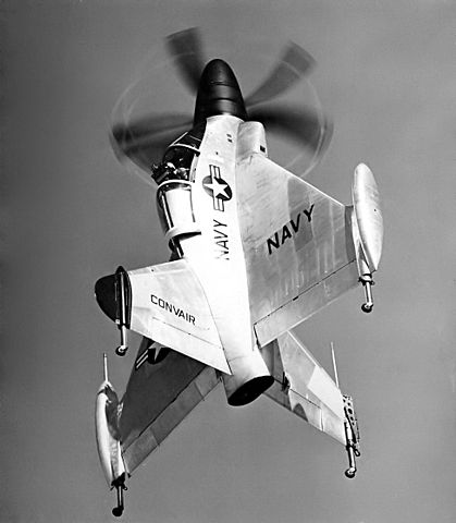
These aircraft require no takeoff or landing run, and are therefore typically chosen in situations where limitations of terrain require this specialized capability.
Aircraft of this type operate at varying altitudes depending on their mission profile, but predominantly fly at low altitudes.
High power requirements for hovering flight limit the flight durations for VTOLs, except in the largest sizes where increased lifting capabilities accommodate large fuel capacity.
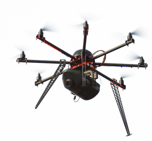
3. LASE (Low Altitude, Short-Endurance)
systems, also known as sUAS, small unmanned aircraft systems, also obviate the need for runways with aircraft optimized for easy field deployment/recovery and transport. The aircraft component of these systems typically weighs ca. 2–5 kg,
4. LASE Close
This category describes small UAS whose aircraft do require runways, but whose larger size and weight confer increased capabilities. These systems operate at up to ca. 1,500 m altitude and may remain aloft for multiple hours, although these limits have been substantially exceeded by specially-modified “record-breaker” aircraft.
5. LALE (Low Altitude, Long Endurance)
Typically at the upper end of the “sUAS” weight designation by the United States Federal Aviation Administration (FAA; see below), these UAS may carry payloads of several kg at altitudes of a few thousand meters for extended periods.
6. MALE (Medium Altitude, Long Endurance)
aircraft are typically much larger than low-altitude classes of UAVs, operating at altitudes up to ca. 9,000 m on flights hundreds of km from their ground stations lasting many hours. HALE (High Altitude, Long Endurance): These are the largest and most complex of the UAS, with aircraft larger than many general-aviation manned aircraft. These UAVs may fly at altitudes of 20,000 m or more on missions that extend thousands of km. Some HALE aircraft have flight durations over 30 h, and have set records for altitude and flight duration.
The last decade of UAV’s creation offer to revolutionize natural resources management, remote sensing and numerous others field to the same degree as the advent of GIS many years ago. The continued trend of increasingly miniaturized components promises an era of tailored systems for on-demand remote sensing at extraordinary levels of sensor precision and navigational accuracy. The latter capability in particular will lead to the ability of researchers to remotely establish study sites at small spatial scales for fine-scale projects that can be repeatedly sampled without resorting to ground-control points, frequently obviating the need for site visits.
Applications and Conclusion
Based on the prolific performance and capabilities, the UAVs are often distinguished for the different purposes and their capabilities results the specific demonstration missions.
Based on the current involvements and missions mainly UAVs are used for the purpose of fire detections and disaster response situations.
Beyond fire and disaster response, LASE and MALE UAS aircraft will provide a host of cost-competitive applications in resource mapping and monitoring applications. Some of the visionary application includes:
- Forest health monitoring: This application requires advanced electro-optical (E/O) sensor payloads, such as near-infrared and (in some cases) hyper spectral. Due to large areas of coverage required, MALE UAS are likely to be favored in the near term.
- Wildlife surveys: Terrestrial flights for large-animal surveys have been conducted using LASE UAS, while MALE aircraft may be preferred for marine surveys due to requirements for extended operations.
- Avalanche patrols: Depending on local facilities and preferred operations styles, this application may utilize either MAVs carried by rescue personnel, or LASE or MALE UAS operated from larger or fixed stations.
- Air quality monitoring: Sampling payloads may require the additional lift capacity of larger UAS, but generally the geographic scope of the mission profile will determine whether short-duration flights by VTOL or the greater coverage and duration offered by LASE or MALE UAS are preferred.
- Mine surveys: Operation inside small, confined areas without GPS coverage make VTOL and MAV or NAV UAS a likely choice for enclosed mines, while larger LASE or VTOL with exotic payloads (e.g., LIDAR, RADAR) can be envisaged to improve surveys and operations in open-pit mines.
- Groundwater discharge monitoring: Because these surveys are likely to take place over areas with easily-identified ground-control points (GCPs), the high costs associated with high-precision georeferencing payloads may not be necessary for UAS use by agencies charged with these missions. In the case of local-scale missions of this profile, LASE UAS equipped with visible-spectrum or IR payloads (for nocturnal surveys) may be used.
Citation to Original Paper
Watts, A.C.; Ambrosia, V.G.; Hinkley, E.A. Unmanned Aircraft Systems in Remote Sensing and Scientific Research: Classification and Considerations of Use. Remote Sens. 2012, 4, 1671-1692.
Was this summary helpful?
Mention in the comments section below, and do not forget to check our other research summaries and general blogs.